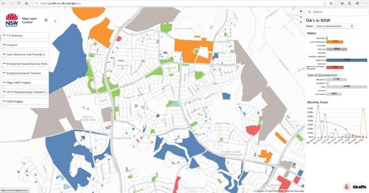
When we first wrote about the NSW Spatial Digital Twin, it was a concept proposed through the NSW State Infrastructure Strategy. Now, post launch of the Minimum Viable Product (MVP) in 2020, the Spatial Digital Twin is gateway for citizens, developers, planners, and government decision makers to visualise our built and natural environment across an ever-increasing geographic extent.
It is a key part of planning future cities, new developments and engaging the people of NSW. Now anyone can visualise what is being planned and what things might look like at early stages of development. This also means that changes to plans can be visualised in almost real-time.
How did we design and deliver the Spatial Digital Twin?
The design and delivery of Spatial Digital Twin required collaboration and partnerships with other government agencies such as NSW Department of Planning, Industry and Environment (NSW DPIE) and Transport for NSW. The team also collaborated with Emergency Services Organisations, and Resilience NSW to prepare for bushfire response and recovery.
DCS Spatial Services has also worked closely with industry Giraffe Technology has built and continues to develop a powerful planning platform that leverages live digital data services from both Spatial Services and DPIE's ePlanning Service. The services demonstrate the ability for organisations to assemble rich data from our world-leading digital twin ecosystem as well as their own data into models and develop innovative tools.
Increasingly, with the integration of new datasets and collaborations with industry and other government agencies, the digital twin is delivering a digital workbench that enables government, citizens and industry to visualise their own data, paving the way for world-leading innovation in NSW - and best of all, access is free.

Who can use the Spatial Digital Twin?
The Spatial Digital Twin is used by NSW Government agencies - NSW DPIE, Transport for NSW, Resilience NSW and Emergency Services Organisations. It can also be used by citizens, industry developers and planners. With the help of this service:
- Citizens can now search and discover open datasets to visualise in the Spatial Digital Twin. With this free service, they now have access to world-leading digital information and innovation.
- Government agencies are able to work more collaboratively, deliver better services and provide a platform for better informed decision making in an increasingly digital economy and society.
- Industry have access to accurate, real-time spatial data that allows them to design more confidently and efficiently by leveraging the data in the Spatial Digital Twin. As an example, utilities above and below the ground.
What's coming up in future?
Following the NSW Independent Bushfire Inquiry, DCS Spatial Services is developing a 3D spatial dataset of Government Radio Network telecommunications towers and other communication and infrastructure assets across NSW to assist with emergency management and response. The delivery of this project will ensure citizens have the greatest possible prospect of retaining communications connectivity during emergencies.