Can you tell us about your organisation and its purpose?
DCS Spatial Services provides NSW's spatial and land information services. Our data products provide the foundation for NSW's mapping and spatial information systems and are used for building better services across the community, government, industry and the environmental sectors. Our functions include:
- Foundation spatial data products and services (SIX Maps, Spatial Collaboration Portal, topographic maps, aerial imagery and LiDAR)
- Emergency information coordination
- Survey operations (CORSnet-NSW, Survey Control Information Management System, State control survey, surveying legislation)
- Board of Surveying and Spatial Information
- Geographical Names Board
- Digital Services (printing and graphic design)
We're undertaking a range of projects based on the Foundation Spatial Data Framework (FSDF) to streamline government processes in terms of planning, design and modelling for NSW's future needs.
Key projects include:
- Live NSW: This incorporates the Spatial Digital Twin (a cross-sector, collaborative environment which will share and visualise a 4D model) and the Gravity Model (critical geoscience information for infrastructure projects and the management of natural hazards and resources).
- Cadastre NSW: A service for local government authorities to capture and visualise the progress of subdivision developments and increase efficiencies for planning and land development while providing access to intelligent digital property data.
- Digital Survey Plans: Transitioning from âpaper' to intelligent digital survey plans to support a more efficient, accurate and accessible land title system.
- Survey Plan Digitisation Project: Digitisation of hard copy survey and strata plans into LandXML and GeoPackage formats.
- Historical Aerial Photography Enhancement Project: Using NSW's 70-year repository of aerial photography to create a 3D digital database to understand how the landscape has altered and to preserve the archival records.
- Whole-of-Government Addressing: The roll out and use of the authoritative NSW Address Database for address verification throughout NSW Government agencies via NSW Point.
Who are your key customers?
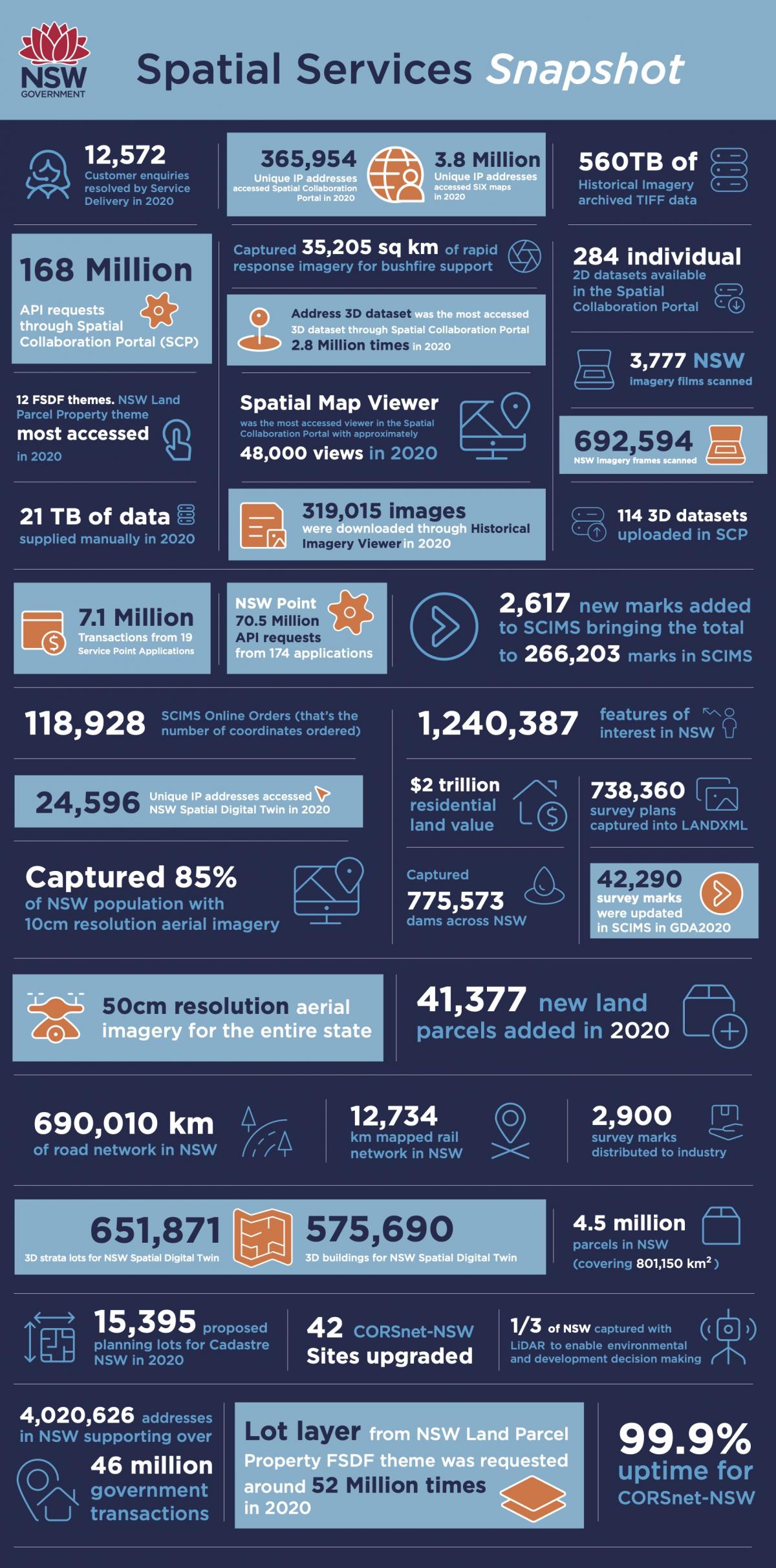
Everything happens somewhere, and spatial data supports evidence-based decision making, so our customers are the people of NSW - this includes members of the public, businesses, industry, academia and all levels of government. As an example, our SIX Maps platform has over 10,000 hits a week, in 2020 we had 3.8 million unique IP addresses access the service, with users including everyone from fencing contractors and plumbers through to surveyors, planners and local councils.
As the regulator of the surveying profession, we have a strong working relationship with the surveying and geospatial industry including the professional associations (such as Australian Computing Society, the Institute of Surveyors NSW and Surveying and Spatial Sciences Institute.
Another core customer is the emergency management sector who rely on our data and services to respond to multi-agency emergencies such as natural disasters, biosecurity threats and terrorism.
What are you most proud of this year?
I am most proud of my team at Spatial Services and the unique workplace culture at its heart. After the passing of our previous Executive Director, Bruce Thompson, from cancer last October, our team rallied to support each other emotionally and professionally. Despite many challenges they continue to successfully deliver the Live NSW (Spatial Digital Twin) program that Bruce was extremely passionate about.
COVID-19, floods and bushfires have presented challenges that demanded we swiftly adapt on many fronts over the past few years. Just a few of the ways my team were involved in supporting the government response included;
- Providing a whole-of-government address validation service, NSW Point, which underpinned the success of border permits and programs like Dine and Discover.
- Coordination, capture and processing of bushfire and flood imagery.
- Our Emergency Information Coordination Unit (EICU) which has been operational on natural disaster, health emergency and biosecurity activities for 75% of the time over the past three years, while also maintaining their BAU responsibilities.
Our people are our biggest asset, I'm lucky to have some of, if not the best subject matter experts in my team, with a great culture of continual improvement, innovation and collaboration #TeamSpatial
What are your headwinds?
These vary across our projects and services, but one key area that is affecting all parts of our program is the digital skills shortage which is impacting our ability to attract and retain talent. This issue isn't unique to us or even government, with the effects also being felt by our industry partners, having real impacts on our collective ability to deliver on a wide range of digital transformation initiatives.
For a number of years, there has been a documented skills shortage in the surveying and geospatial sector and so we're focused on collaborating with industry to raise the profile of the profession with primary and high school students to try to attract new talent into the pipeline Surveying Careers.
Most visited App?
In an attempt to give separation between work and my personal life, I have two mobile phones:
Work
- MS Outlook
- MS Teams
Personal
- Kindle
- TikTok
On weekends, I enjoy
Spending time with my family. I have two kids and a husband who all play a variety of sports, so our weekends are often spent coordinating calendars to make sure everyone is where they need to be at the right time.
Up until recently I played AFL, but I've had to put that on hold at the moment as I'm undertaking an Executive Masters in Public Administration through ANZSOG, so I need to spend time on the weekend completing assessments.
When I have free time, I like to read (hence Kindle being my most used app on my personal phone), watch movies and build Lego
